Funded by: CAL FIRE
Across Borderlines: Sonoma-Napa Project is a Model of Cooperation
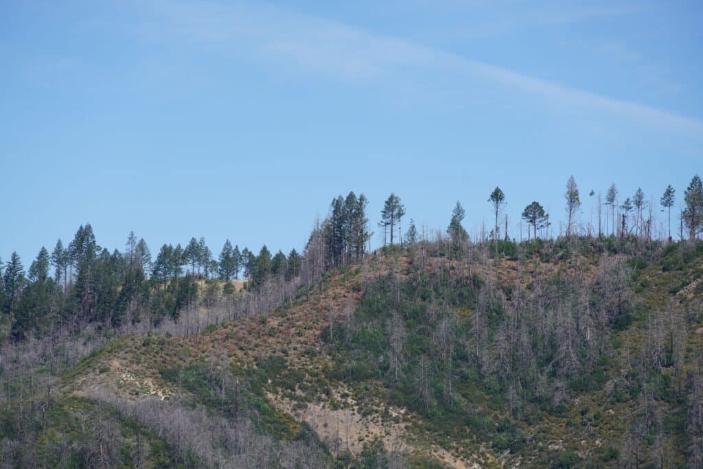
On a ridge high above Napa Valley, the morning air carries the scent of pine, oak and freshly cut brush. To the west lies Sonoma County; to the east, Napa. Below, vineyards trace neat green lines across the landscape. But the men and women working here aren’t admiring the view. They’re looking for dead trees that could throw embers miles ahead of a wildfire; ladder fuels that could carry flames into the canopy; and strategic opportunities to create a safer future along one of Northern California’s most fire-prone corridors.
For Napa Firewise Land Resilience Program Manager Steven Burgess, this ridgeline represents something larger than a fuel reduction project.
“It has become a model for how public agencies, private landowners, and other partners can work together to build a continuous line of defense against wildfire,” Burgess said.
Wildfire doesn’t stop at county lines. It moves across a landscape according to fuels, weather, topography and opportunity. That’s why one of Napa Firewise’s most ambitious projects, funded by CalFire, is focused on creating a wildfire resilience corridor along the Sonoma-Napa border.
At the core of the project are strategically located shaded fuel breaks where vegetation is carefully thinned to reduce wildfire intensity while maintaining a healthy forest canopy. Shaded fuel breaks are designed to slow fire movement, reduce ember production, and provide firefighters with safer places to work.
One of the project’s most significant accomplishments stretches across a ridgeline between Diamond Mountain Road and Spring Mountain Road. The corridor connects existing roads and vineyard landscapes, creating a tactical advantage for firefighters.
“You always want to tie a fuel break into something,” Burgess explained. “This one is tied into Diamond Mountain Road on one side and Spring Mountain Road on the other.”
The location presents unique challenges. Much of the terrain is steep, rugged, and inaccessible to vehicles. Some of the project area falls within California State Park lands, where even the best ideas must move through a lengthy, multi-layered approval process. Anyone who has shepherded a project through a large bureaucracy knows the drill: progress comes one step at a time, and patience is part of the job. That’s what makes a recent breakthrough so significant. After considerable effort behind the scenes, the project received a key approval that moves this long-planned work closer to reality.
Obtaining permission to work within State Park property represents a major milestone. The strength of the Sonoma-Napa Project and the shared commitment to wildfire resilience brought partners together around a common goal, resulting in a unique example of public agencies and private landowners working side-by-side to improve safety across an entire landscape.
Burgess says one achievement stands above all others. “The neighbors here, every property owner along this path, agreed to participate,” he said. “A 100 percent participation rate is remarkable.”
Wildfire mitigation projects often begin with fire science and project design long before landowner approvals are secured. Considerable planning can occur before a single tree is cut or a single burn pile is built. A lack of support from even one property owner can create gaps that weaken a project’s effectiveness.
Here every landowner involved chose to participate, creating a continuous treatment area that will provide greater protection than isolated projects ever could.
Progress has been substantial despite a challenging winter season. Winter rains typically provide extended opportunities for burning slash piles. Unusually dry conditions this year limited those opportunities. Contractors focused instead on work that could continue regardless of weather conditions: cutting brush, removing hazardous vegetation, and eliminating ladder fuels—low-hanging branches and vegetation that can allow fire to climb from the forest floor into the tree canopy.
The work also included removing dead standing trees along windy ridge tops, where burning dead trees—known as snags—can produce embers capable of being carried by wind and starting spot fires far ahead of the main fire front.
“Dead standing trees are a danger to firefighters and when on fire can send embers overhead to ignite spot fires,” Burgess explained. “Removing dead standing trees is an important project goal.”
Spring rain eventually allowed crews to burn hundreds of accumulated burn piles, with thousands more expected as work continues. The break stretches approximately 500 to 600 feet wide in places, creating a substantial buffer intended to reduce wildfire intensity and improve firefighter access, safety and effectiveness.
But perhaps the most important aspect of the Sonoma-Napa Project is its broader vision. The recently completed Hogback Ridge Fuel Break is just one piece of a larger strategy to create a continuous network of wildfire resilience projects along the Sonoma-Napa border. By connecting fuel treatments, improving access, and strengthening partnerships, the project aims to make both counties safer and better prepared for future wildfires.
In a region where wildfire remains one of the greatest threats to communities, watersheds, and local economies, the Sonoma-Napa Project demonstrates what can happen when organizations and landowners look beyond boundaries and focus on shared solutions.
Because when wildfire arrives, it won’t care where Sonoma ends and Napa begins.
Funding for this project provided by the California Department of Forestry and Fire Protection’s (CAL FIRE) Wildfire Prevention Grants Program.